Point clouds can be exported to other formats and transformed between known coordinate systems.
LiMON enables transformation of point clouds between all EPSG coordinate systems available in the program database.
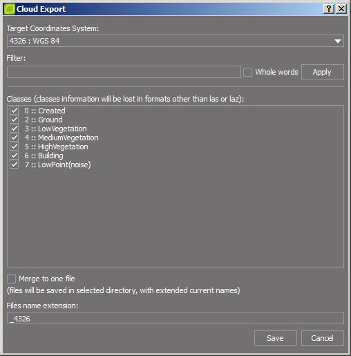
To export / transform point clouds:
1.Set the coordinate system of the project (it must be compatible with the coordinate system of the source data),
2.In the Project Manager, select point clouds which will be exported / transformed, then right-click on them and select the Export selected option,
3.To transform point cloud, in the Cloud Export window, define the target coordinate system (you can search it using filter),
4.Select classes which will be saved in output files,
Note: Information about classes will be lost in formats other than *.las or *.laz.
5.The Merge to one file option is selected by default, if you want the particular clouds to be saved as separate files, uncheck this option and define the extension for the name of the output files (corresponding EPSG code is set by default),
6.Click the Save button, and then indicate the directory and file format for exported / transformed point clouds.