Window >> Editor toolbar >> Classification settings (Automatic option) >> Ground (tab)
Introduction
Classification of ground points is of fundamental importance to the whole classification process. Ground points need to be classified correctly in order to successfully detect buildings and vegetation in the further steps of classification. Ground classification always runs in two stages:
1.Ground seed point detection
2.Ground growth based on ground seed points
Ground seed point detection algorithm was broadly outlined in the preceding section. Just to remember: H-index subdivision parameter determines how densely ground seed points will be located and which points will finally be classified as ground. During the ground growth, each point that was not already classified as a ground point is evaluated against certain geometrical criteria and assigned or not the ground class. The process runs iteratively and is described in more details in the following section.
Ground growth
In each iteration of ground growth, each* point that does not have class = ground is subjected to ground classification. This means that:
Before the first iteration step, only ground seed points have class = ground
The number of ground points (NG): NGk >= NGk-1, where k stands for the iteration step.
The second statement means that the number of ground points is increasing while the classification process runs. The iteration process breaks when:
1. NGk - NGk-1 = 0 (there are no new ground points)
OR
2. k = K
where K stands for the maximum number of iterations.
Consequently for each ground candidate:
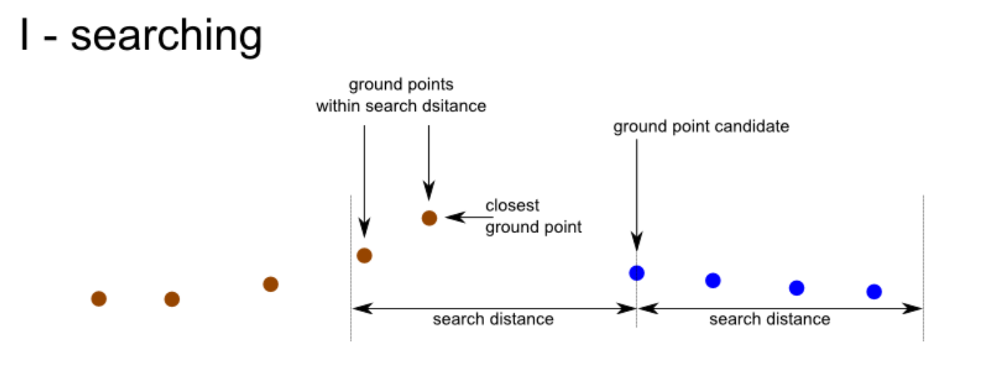
1.The nearest ground point that is located within "search distance" is searched for.
2.If the ground point is found the candidate point is evaluated against geometrical criteria. So for each candidate, two actions are taken: I-searching, II-evaluation. Above mentioned processes are illustrated in the figure below. Ground points are marked in brown, candidate points are marked in blue.
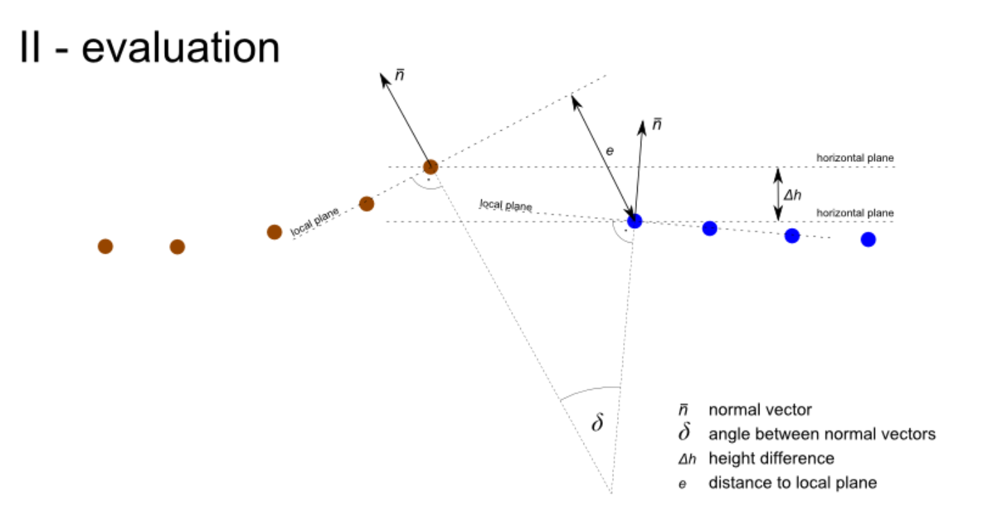
In the evaluation procedure, certain geometric quantities are calculated for a candidate - nearest ground point pair. Three of them:
1.angle between normal vectors,
2.height difference,
3.distance to local plane,
przedstawiono na powyższym rysunku.
In the evaluation procedure, certain geometric quantities are calculated for a candidate - nearest ground point pair. Three of them:
1.angle between normal vectors,
2.height difference,
3.distance to local plane,
are shown in the figure above.
Intuitively we see that for flat surfaces δ, Δh and e will more likely be smaller than for hilly terrain. Threshold values of δmax , Δhmax, emax parameters or Ground searching strategy and number of iterations in the LiMON Editor PRO will change depending on the selected classification strategy and the position of the Ground Extraction Tuning slider.

Classification settings
Ground search strategy settings influence the number of iterations and search distances. Moreover, ground point searching and classification with a certain number of iterations is run many times. Each time searching distance can be different and each time different geometrical constraints can be applied.
* excluding low-points and overlap points and also other points that are unlikely to represent ground (for example points which return number does not equal the number of returns) - however, this depends on the current implementation and software version.
Ground classification settings:
Ground Searching Strategy |
Determine the strategy for searching for ground points candidates. a) Careful -uses less iteration steps with smaller searching distance. Appropriate with mixed terrain with buildings and hills. b) Normal - uses intermediate number of iterations also with medium to long distances. Appropriate for broad range of terrain types. c) Intensive - uses high number of iterations also with medium to long distances. Appropriate for ground expansion on flat terrain. |
Ground Expansion Strategy |
Determine the approach to adding points to ground class a) Careful - Applies more demanding criteria to classifying each candidate ground class. Performs well in flat terrain. b) Aggressive - Applies less demanding criteria to candidate points allowing ground expansion also in hilly terrain. |
Ground Extraction Tuning |
Modifies selected general ground classification strategy towards more (+1) or less (-1) aggressive. |
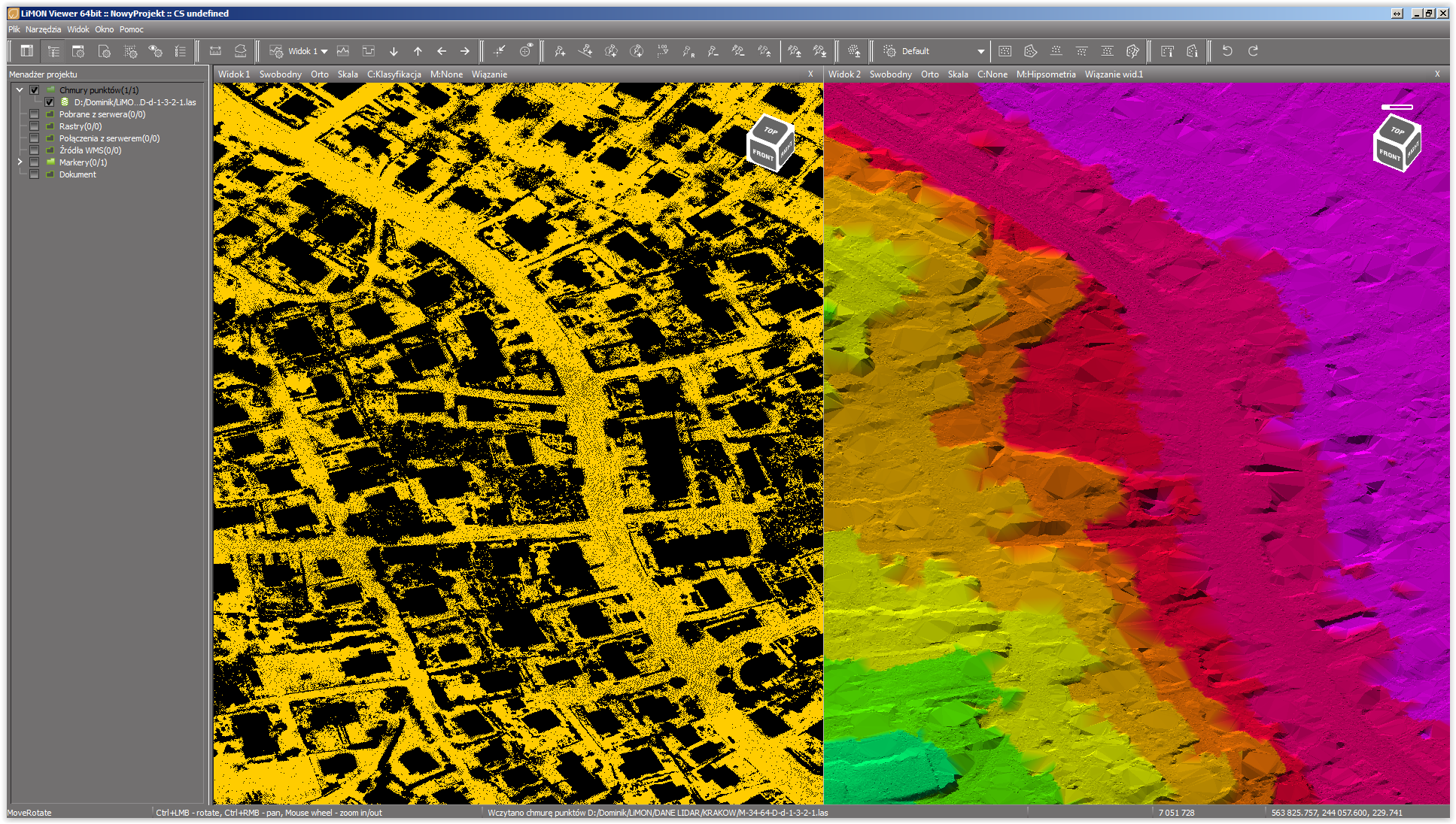
point cloud and model with the ground class displayed
Hotkey: Edit.SettingsDialog